
About
Cintoo is a cloud-based digital twin platform purpose-built for reality capture professionals who need to transform raw 3D scan data into actionable, high-fidelity digital twins. At its core is TurboMesh, a patented technology that converts massive point cloud datasets into lightweight, streamable 3D meshes—enabling global teams to collaborate and share scan data at scale without the burden of heavy files or local processing constraints. The platform is fully scanner-agnostic, supporting data from any laser scanner or reality capture device including Trimble, Leica, Faro, and Z+F, giving organizations complete flexibility without vendor lock-in. Cintoo offers multiple tailored editions: BIM Edition for scan-to-BIM and as-built documentation, Twin Edition for operational digital twin management, 360 Edition for panoramic visualization, and a Metaverse edition for immersive VR experiences powered by Unreal Engine. Designed for enterprise-scale collaboration, Cintoo features an unlimited business model—unlimited users, unlimited web access, and unlimited virtual site visits—removing traditional barriers to teamwork. AI-powered classification automatically recognizes, categorizes, and structures 3D scan data, turning raw point clouds into actionable insights and significantly reducing manual effort. Open SDKs and APIs enable seamless integration with BIM, GIS, and Digital Twin ecosystems, positioning Cintoo as a single source of truth for all reality capture data. Industries served include architecture, engineering, construction (AEC), heritage preservation, infrastructure, and manufacturing. Whether conducting virtual site inspections, overlaying BIM models, or enabling remote collaboration on large-scale facility scans, Cintoo delivers clarity, performance, and enterprise-grade security at global scale.
Key Features
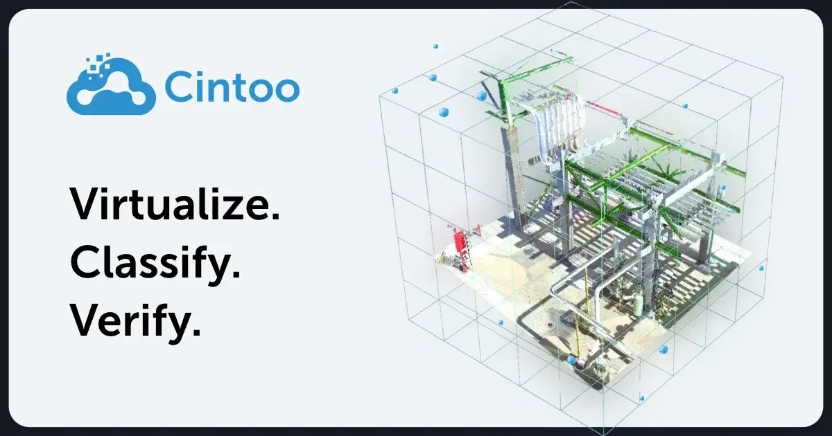
- TurboMesh Point Cloud to Mesh Conversion: Patented technology that transforms massive, complex point cloud datasets into lightweight, high-fidelity 3D meshes that can be streamed, shared, and collaborated on in the cloud without accuracy loss.
- AI-Powered Data Classification: Advanced AI automatically recognizes, categorizes, and structures 3D scan data, turning raw point clouds into actionable insights and accelerating workflows while reducing manual classification effort.
- Open SDK & API Integrations: Connect all reality capture data into a single source of truth with open SDKs and APIs that enable seamless data exchange with BIM, GIS, and Digital Twin platforms across your existing tech stack.
- Metaverse & VR Experience: Access high-fidelity scan data in an immersive VR environment powered by Unreal Engine, enabling cloud-connected virtual navigation of scanned facilities for remote collaboration and decision-making.
- Scanner-Agnostic Multimodal Support: Integrates 3D scan data from any laser scanner or reality capture device (Trimble, Leica, Faro, Z+F, and more), providing full flexibility without vendor lock-in across all hardware ecosystems.
Use Cases
- Scan-to-BIM workflows for AEC firms needing accurate as-built documentation of existing buildings and infrastructure before renovation or construction projects.
- Operational digital twin management for facility managers who need a live, cloud-accessible model of their plant, building, or infrastructure for ongoing inspections and maintenance planning.
- Heritage preservation and cultural documentation by digitizing historical structures, baptistries, and monuments into high-fidelity 3D meshes for archival and research purposes.
- Remote virtual site inspections that allow project stakeholders, clients, and distributed teams to navigate and review scanned facilities without physically traveling to the site.
- Infrastructure asset management for rail, bridge, and civil engineering projects requiring precise 3D documentation, classification, and ongoing monitoring of large-scale physical assets.
Pros
- Truly Scanner-Agnostic: Supports data from virtually any laser scanner or reality capture device, giving AEC and infrastructure teams the freedom to use their existing hardware without switching vendors.
- Unlimited Collaboration Model: The unlimited-user, unlimited-access business model removes collaboration barriers, allowing entire organizations to access and share 3D scan data without per-seat licensing friction.
- Cloud-Based Global Accessibility: Securely upload, process, and visualize massive 3D scan datasets from anywhere in the world, enabling distributed teams to work together on large-scale projects in real time.
- AI Automation Reduces Manual Effort: AI-powered classification automatically structures raw scan data into actionable insights, drastically reducing the time teams spend on manual point cloud processing and annotation.
Cons
- Enterprise-Level Pricing: As a specialized enterprise digital twin platform, Cintoo is likely cost-prohibitive for individual users, small firms, or teams with limited reality capture budgets.
- Web-Only Platform: Cintoo is primarily a cloud-based web platform with no standalone desktop application, which may limit usability in environments with restricted internet access or connectivity.
- Learning Curve for New Users: The platform's breadth of features—multiple editions, BIM integrations, API configuration, and AI classification—can present a steep onboarding curve for teams new to digital twin workflows.
Frequently Asked Questions
What is TurboMesh and why does it matter?
TurboMesh is Cintoo's patented technology that converts heavy point cloud datasets into lightweight, high-fidelity 3D meshes. This makes it practical to stream, share, and collaborate on massive scan data in the cloud without sacrificing accuracy or performance—a key differentiator over traditional point cloud workflows.
Which 3D scanners and devices does Cintoo support?
Cintoo is fully scanner-agnostic and supports data from all major laser scanners and reality capture devices, including Trimble, Leica BLK360, Faro, and Z+F scanners, among others. This ensures teams are not locked into a single vendor's ecosystem.
Can Cintoo integrate with BIM software like Revit?
Yes. Cintoo supports overlaying BIM models (including Revit models) directly within the platform and provides open SDKs and APIs for seamless data exchange with BIM, GIS, and Digital Twin platforms, making it easy to incorporate into existing AEC workflows.
What editions of Cintoo are available?
Cintoo offers four editions: BIM Edition (for scan-to-BIM and as-built documentation), Twin Edition (for operational digital twin management), 360 Edition (for panoramic visualization), and a Metaverse edition (for immersive VR experiences powered by Unreal Engine).
Is Cintoo suitable for heritage preservation and infrastructure projects?
Yes. Cintoo is actively used in heritage preservation (e.g., scanning historical buildings and baptistries), infrastructure (train stations, bridges), and MEP facilities. Its high-fidelity mesh output and virtual site visit capabilities make it ideal for documenting and managing complex physical assets across industries.