
H
About
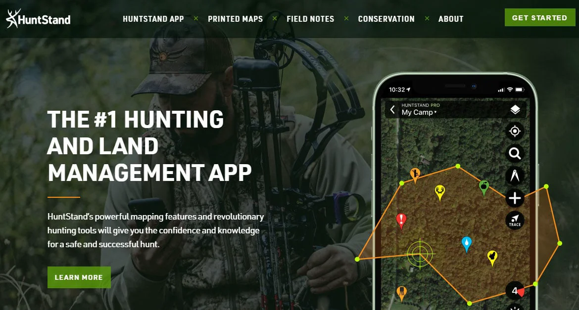
HuntStand is a comprehensive hunting and land management application developed by TerraStride Inc., recognized as the #1 hunting app in the country with more than 2 million active hunters and 210 million acres managed on the platform. Over a decade of development has produced an indispensable toolset that merges advanced cartography with practical hunting intelligence. The app delivers nationwide property boundaries and public land maps, monthly-updated satellite imagery, offline mapping for remote areas, and 3D terrain visualization. Hunters can log stand locations, manage trail cameras, reserve hunting stands, and record harvests — with over 6.2 million harvests tracked to date across 4.8 million hunt areas. Pro subscribers gain access to premium layers including a Whitetail Activity Forecast, a Whitetail Rut Map, and a new Water Feature Overlay designed for turkey e-scouting. The platform also supports printed custom maps, allowing hunters to take their digital plans into the field in a tangible format. HuntStand is built by hunters, for hunters, sitting at the intersection of technology and outdoor tradition. It actively partners with conservation organizations and sporting brands to support the future of hunting and the shooting sports. Whether you are a weekend deer hunter, a serious land manager, or a habitat conservationist, HuntStand provides the data and tools to plan, execute, and record every hunt with confidence.
Key Features
- Advanced Mapping & Satellite Imagery: Access monthly-updated high-resolution satellite imagery, nationwide public land maps, and 3D terrain visualization to scout and plan hunts from anywhere.
- Nationwide Property Boundaries: View precise public and private land boundaries across the entire country so hunters always know exactly where they stand legally.
- Whitetail Activity Forecast & Rut Map: Pro subscribers receive AI-driven whitetail activity predictions and a rut map to identify peak movement windows and maximize harvest success.
- Trail Camera & Stand Management: Organize trail camera photos, log stand locations, reserve hunting stands, and record harvest data all within a single integrated platform.
- Offline Mapping: Download maps for offline use so hunters maintain full functionality in remote areas with no cell service.
Use Cases
- Deer hunters using property boundaries and satellite imagery to scout private and public land before the season opens.
- Land managers tracking habitat improvements, stand locations, and harvest records across hundreds of acres over multiple seasons.
- Turkey hunters leveraging the Water Feature Overlay and public land maps to identify reliable water sources during spring e-scouting.
- Hunting camp groups using Stand Reservations to coordinate who is hunting which location each morning to avoid conflicts.
- Hunters planning remote backcountry trips who need offline maps and 3D terrain visualization to navigate safely without cell service.
Pros
- Massive Active Community: With over 2 million active hunters and 4.8 million hunt areas, the platform benefits from crowd-sourced scale and a rich, real-world dataset.
- All-in-One Platform: Combines mapping, property data, satellite imagery, forecasting, trail cam management, and harvest logging so hunters don't need multiple apps.
- Affordable Pro Tier: Pro subscriptions provide the most affordable nationwide public and private lands data available, making premium features accessible to everyday hunters.
Cons
- Best Features Locked Behind Pro: Key capabilities like satellite imagery updates, property boundaries, whitetail forecasting, and offline maps require a paid Pro subscription.
- Primarily US-Focused: Land data, property boundaries, and public land layers are centered on the United States, limiting utility for international hunters.
Frequently Asked Questions
Is HuntStand free to use?
Yes, HuntStand offers a free tier with core mapping and hunt area features. A Pro subscription unlocks advanced capabilities like nationwide property boundaries, monthly satellite imagery, offline mapping, and whitetail forecasting.
What platforms is HuntStand available on?
HuntStand is available on iOS and Android mobile devices, as well as accessible via the web at huntstand.com.
What is the Whitetail Activity Forecast?
The Whitetail Activity Forecast is a Pro feature that uses environmental and behavioral data to predict peak deer movement times, helping hunters choose the best windows to be in the field.
Can I use HuntStand without cell service?
Yes, Pro subscribers can download maps for offline use, ensuring full mapping functionality even in remote areas without cellular coverage.
Can I order a printed version of my hunt map?
Yes, HuntStand allows users to create detailed custom hunt area maps and order printed versions in various sizes and materials through the Printed Maps feature.