
About
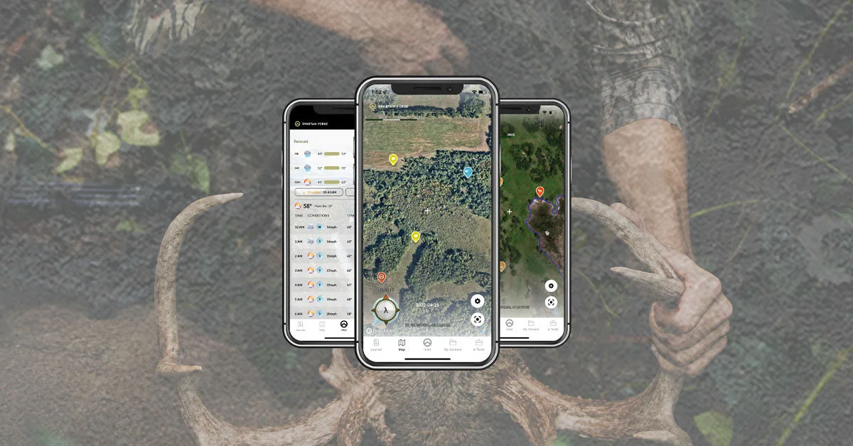
Spartan Forge is an AI-powered hunting platform built at the intersection of machine learning and white-tailed deer hunting. Designed by veterans and field-tested by serious hunters, it aims to save time on scouting, planning, and execution by delivering truly science-based intelligence. At the heart of the platform is its deer movement prediction engine — the only one in the hunting industry to leverage a neural network trained on thousands of years of GPS deer collar data from trusted universities. This model analyzes real-time environmental conditions and local terrain to forecast when and where deer are likely to move, going far beyond generic rut calendars. Spartan Forge also features industry-leading LiDAR imagery that cuts through tree canopies to expose hidden terrain details like ridgelines, funnels, and bedding areas. Complementing this is high-resolution UAV aerial imagery and 10 years of historical imagery, making e-scouting more detailed and accurate than ever before. Full 3D map views add another dimension to pre-season planning. The Blue Force Tracker enables real-time live pin sharing within hunting teams. Users define a boundary on the map, invite partners to a group, and all pins dropped inside are automatically shared — streamlining communication without third-party apps. Additional features include CyberScout journaling tools, integration with Eastmans' TagHub, and a thriving hunting community. Available on iOS and Android, Spartan Forge is the definitive mapping and AI intelligence platform for the modern whitetail hunter.
Key Features
- AI Deer Movement Prediction: Uses a neural network trained on thousands of years of GPS deer collar data from universities to predict whitetail deer movement based on conditions and local terrain.
- LiDAR & UAV Mapping: Industry-leading LiDAR imagery sees through tree canopies to reveal critical terrain features, paired with the sharpest high-resolution UAV aerial imagery on the market.
- 10 Years of Historical Imagery: Access a decade of historical aerial imagery to understand land changes, identify recurring deer patterns, and e-scout properties across seasons.
- Blue Force Tracker (Live Pin Sharing): Real-time team pin sharing lets hunting partners coordinate on a shared map boundary, with pins inside the polygon automatically shared with the entire group.
- CyberScout Journaling: Log hunt observations, scouting notes, and field data in-app for ongoing pattern analysis and multi-season record-keeping.
Use Cases
- E-scouting hunting properties before the season using LiDAR and UAV imagery to identify funnels, ridgelines, bedding areas, and travel corridors.
- Predicting peak whitetail deer movement windows using AI analysis of real-time weather conditions and local terrain data.
- Coordinating group or party hunts in real-time using Blue Force Tracker live pin sharing without relying on separate communication apps.
- Planning optimal stand, blind, or treestand placement by analyzing 3D terrain maps and 10 years of historical aerial imagery.
- Logging multi-season hunt observations, scouting notes, and field data in CyberScout to identify long-term deer movement patterns.
Pros
- Science-Backed Prediction Engine: The only hunting app using a real neural network trained on verified university GPS collar data, delivering genuinely data-driven deer movement forecasts.
- Superior Terrain Visibility: LiDAR and UAV mapping far surpass standard satellite imagery by revealing ground-level terrain features hidden beneath forest canopies.
- Seamless Team Coordination: Blue Force Tracker enables real-time live pin sharing within hunting groups, eliminating the need for separate communication apps in the field.
- Cross-Platform Mobile Access: Available on both iOS and Android, ensuring hunters can access maps and predictions from any mobile device in the field.
Cons
- Whitetail-Specific Focus: The AI prediction engine is purpose-built for white-tailed deer, offering limited utility for hunters pursuing other big game species.
- Subscription Required for Full Access: Premium features including LiDAR maps, deer predictions, and UAV imagery are locked behind a paid subscription after the 7-day free trial.
- Primarily North American Coverage: Map quality and deer collar data are centered on North American regions, making the platform less useful for hunters outside the U.S.
Frequently Asked Questions
How does Spartan Forge predict whitetail deer movement?
Spartan Forge uses a proprietary neural network trained on thousands of years of GPS deer collar data collected by trusted universities. It combines this historical movement data with real-time weather conditions and terrain analysis for your specific hunting area to forecast likely deer activity windows.
Is Spartan Forge available on iPhone and Android?
Yes, Spartan Forge is available for download on both iOS (iPhone/iPad) and Android devices, allowing full access to maps, predictions, and team features from the field.
What is the Blue Force Tracker?
Blue Force Tracker is a real-time team pin-sharing feature. You draw a boundary on your map, invite hunting partners to the group, and any pins dropped within that boundary are automatically shared with all members — making group hunt coordination seamless.
What makes LiDAR mapping better than standard satellite maps?
LiDAR (Light Detection and Ranging) uses laser pulses to penetrate forest canopies and map the actual ground surface below. This reveals hidden terrain features like ridgelines, saddles, funnels, and bedding areas that are completely invisible on conventional satellite or aerial imagery.
Does Spartan Forge offer a free trial?
Yes, Spartan Forge offers a 7-day free trial so hunters can explore the full feature set — including deer predictions, LiDAR maps, and team tools — before committing to a subscription.