
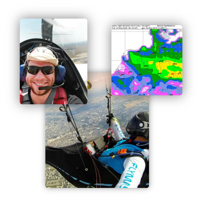

About
TopMeteo is a comprehensive aviation weather service developed by a team of professional meteorologists who are also passionate pilots. The platform caters to glider pilots, motor pilots, hang gliders, paragliders, and balloon pilots, offering discipline-specific forecasts and planning tools across Europe, Africa, and the USA. For glider pilots, TopMeteo provides thermal maps, Potential Flight Distance (PFD) forecasts, thermal newsletters, and flight planning tools. Motor pilots benefit from GAFOR area forecasts, METARs, TAFs, and detailed area outlooks. Paraglider and hang glider pilots receive high-resolution local and regional wind and thermal forecasts with 1-knot resolution. Balloon pilots get altitude wind data up to 7,000 m MSL along with surface wind, temperature, and gust forecasts. Key capabilities include hourly and daily weather overview maps, satellite imagery, live radar, and in-flight mobile apps such as TopMetSat for real-time cockpit weather. The platform is built on a proprietary European regional weather model developed since 2005, ensuring localized accuracy beyond standard global models. TopMeteo is used by recreational pilots, competitive aviators, and flight schools. Its scalable depth — from quick daily overviews to deep meteorological analysis — makes it suitable for both beginners and seasoned experts. Endorsed by multiple world champions, TopMeteo is a trusted co-pilot for flight planning and in-flight decision-making.
Key Features
- Discipline-Specific Forecasts: Tailored weather briefings for glider, motor, paraglider, hang glider, and balloon pilots with relevant metrics for each flight type.
- Thermal Maps & PFD Forecasts: Detailed thermal charts and Potential Flight Distance (PFD) predictions help soaring pilots maximize cross-country flight performance.
- Live In-Flight Apps: Mobile apps including TopMetSat deliver real-time satellite imagery, radar, and weather data directly into the cockpit.
- METARs, TAFs & GAFOR Data: Comprehensive aviation weather reports and area forecasts for VFR motor pilots planning flights across European airspace.
- Proprietary European Regional Model: Weather predictions powered by a custom regional model developed since 2005, offering greater local accuracy than standard global models.
Use Cases
- A glider pilot uses TopMeteo's thermal maps and PFD forecasts to plan an optimal cross-country soaring route before competition day.
- A VFR motor pilot reviews GAFOR areas, METARs, and TAFs on TopMeteo to ensure safe weather conditions for a weekend flight.
- A paraglider checks high-resolution local wind and thermal forecasts to select the best launch window and altitude for a free-flight session.
- A balloon pilot uses TopMeteo's altitude wind and gust data up to 7,000 m MSL to plan a safe and enjoyable balloon flight.
- A flight school instructor uses TopMeteo's weather briefing tools to teach student pilots how to interpret meteorological data for pre-flight planning.
Pros
- Deep Meteorological Expertise: Founded and operated by certified meteorologists with nearly 30 years of aviation weather experience, ensuring high forecast quality.
- Covers All Pilot Disciplines: A single platform serves glider, motor, paraglider, hang glider, and balloon pilots with specialized, relevant data for each.
- Trusted by World Champions: Endorsed by multiple FAI world champions and top competitive pilots, validating its reliability for high-stakes flight planning.
- Real-Time In-Flight Data: Live apps provide satellite imagery and radar in the cockpit, enabling better in-flight weather decisions.
Cons
- Primarily European Focus: While Africa and the USA are supported, the deepest coverage and model accuracy is concentrated in European airspace.
- Subscription Required for Full Access: Advanced features and detailed forecasts are locked behind paid plans, which may be a barrier for casual or student pilots.
- German-Language Interface: Much of the platform content and marketing is in German, which may limit accessibility for non-German-speaking pilots.
Frequently Asked Questions
What types of pilots is TopMeteo designed for?
TopMeteo serves glider pilots, motor pilots, hang gliders, paragliders, and balloon pilots. Each discipline has a dedicated product with tailored weather data and forecasts.
Does TopMeteo have a mobile app?
Yes, TopMeteo offers in-flight mobile apps including TopMetSat, which provides high-resolution satellite imagery and live radar data accessible in the cockpit.
What regions does TopMeteo cover?
TopMeteo primarily covers Europe but also extends to Africa and the USA, offering aviation weather forecasts across those regions.
Is TopMeteo suitable for beginner pilots?
Yes. TopMeteo is designed to scale — beginners can use quick daily overview maps, while experienced pilots and meteorology enthusiasts can dive deep into detailed forecast data.
How accurate are TopMeteo's forecasts?
TopMeteo uses a proprietary European regional weather model developed since 2005, combined with GFS data and professional meteorologist oversight, delivering highly localized and reliable forecasts.