

About
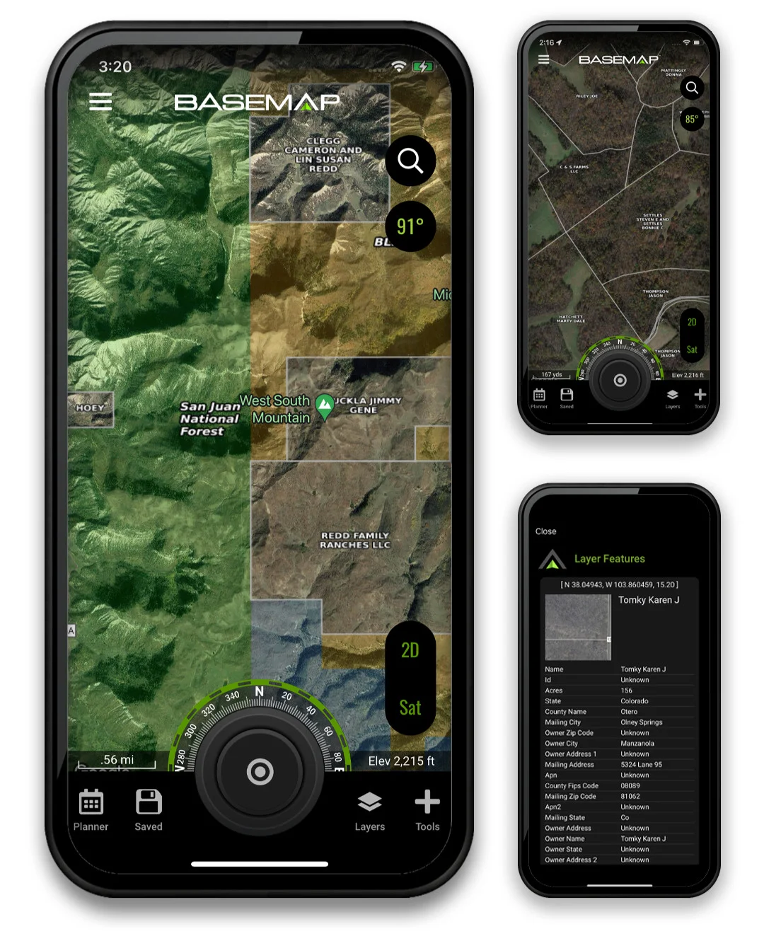
BaseMap is a feature-rich GPS and mapping platform designed specifically for hunters. Trusted by over 1 million users, it provides guaranteed land ownership maps with 150+ million verified parcel records and 175+ million verified addresses, ensuring hunters always know whether the land they're on is public or private. A single membership covers all 50 states, making it an unrivaled value for hunters who travel. The app includes a powerful Hunt Planner with draw odds, harvest statistics, and unit filtering to help hunters research and prepare for any season. HuntWind™ provides a 7-day wind forecast showing ideal, risky, and poor times to hunt specific stands — critical intelligence for serious deer and elk hunters. BaseMap also features XDR Navigation with built-in compass and rangefinder, high-speed offline maps that work without cell service, live location sharing for group hunts, and 800+ map layers including topography, trails, wilderness boundaries, timbercuts, and lake depths. Rangefinder Mapping lets users mark distant targets for game recovery and stalk planning, while custom markers allow full personalization of map content. Additional features include high-resolution satellite imagery for e-scouting, GPS tracking for safe navigation back to camp, and Private Land Access booking for exclusive hunts. BaseMap is available on mobile devices and is ideal for hunters, land scouts, and outdoor enthusiasts who rely on accurate, detailed mapping.
Key Features
- Guaranteed Land Ownership Maps: Access 150+ million verified parcel records and 175+ million verified addresses to instantly know if land is public or private across all 50 states.
- Hunt Planner with Draw Odds: Plan hunts using draw odds, harvest statistics, and unit filtering tools to research and target the best hunting areas and seasons.
- HuntWind™ Wind Forecasting: A 7-day wind forecast system that shows ideal, risky, and poor windows to hunt specific stands, helping hunters maximize their chances.
- High-Speed Offline Maps: Download maps and navigate without cell service using the phone's built-in GPS, with 800+ overlays including topography, trails, and boundaries.
- Live Location Sharing & XDR Navigation: Share real-time location with hunting partners and use XDR navigation with built-in compass and rangefinder for precise point-and-go directions.
Use Cases
- A deer hunter uses BaseMap to identify public land boundaries and locate stand locations with favorable wind conditions before the season starts.
- A western big game hunter uses the Hunt Planner and draw odds tools to research units, apply for tags, and plan a multi-state elk hunting trip.
- A hunting group uses live location sharing during a pack-out to coordinate meat recovery in rugged backcountry terrain.
- An e-scout uses high-resolution satellite imagery and 800+ map layers to study terrain, locate water sources, and plan approach routes before ever stepping foot in the field.
- A traveling hunter relies on offline maps and XDR navigation to safely navigate remote wilderness areas across multiple states with a single membership.
Pros
- All 50 States in One Membership: A single subscription unlocks nationwide coverage, making it ideal for hunters who pursue game across multiple states.
- Massive Verified Data Set: With 150+ million parcel records, BaseMap offers one of the most comprehensive and accurate land ownership databases available to hunters.
- Offline Capability: High-speed offline maps ensure the app is fully functional in remote areas without cell coverage, a critical feature for backcountry hunting.
- All-in-One Hunting Toolkit: Combines mapping, wind forecasting, draw odds, GPS tracking, satellite imagery, and private land access in a single platform.
Cons
- Subscription Required for Full Features: Advanced features like guaranteed land ownership data, HuntWind, and full offline maps require a paid membership.
- Connectivity Needed for Some Features: Live location sharing and certain real-time data features require an active internet connection.
- Hunting-Specific Use Case: The app is purpose-built for hunters, making it less useful for general outdoor recreation or non-hunting land navigation.
Frequently Asked Questions
What is BaseMap?
BaseMap is a GPS hunting app that provides guaranteed land ownership maps, hunt planning tools, offline navigation, wind forecasting, and more — all in one membership covering all 50 states.
Does BaseMap work without cell service?
Yes. BaseMap offers high-speed offline maps that use your phone's built-in GPS, allowing full navigation without any cell or data connection.
How accurate is the land ownership data?
BaseMap offers guaranteed land ownership maps backed by 150+ million verified parcel records and 175+ million verified addresses, making it one of the most accurate sources available.
What is HuntWind™?
HuntWind™ is BaseMap's wind forecasting tool that provides a 7-day forecast showing ideal, risky, and poor times to hunt specific stands based on wind direction and conditions.
Can I access private land hunts through BaseMap?
Yes. BaseMap's Private Land Access feature allows users to book exclusive private land hunts directly through the app.