
About
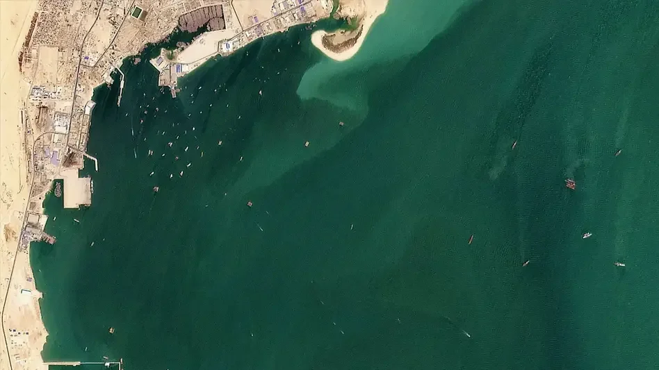
Global Fishing Watch is a nonprofit organization that harnesses cutting-edge AI and satellite technology to transform how humanity monitors and manages the ocean. By combining high-resolution satellite imagery (including partnerships with Planet), vessel Automatic Identification System (AIS) data, and advanced machine learning models, the platform processes millions of gigabytes of data to produce a real-time, first-of-its-kind map of industrial activity at sea. The platform offers a suite of tools including an interactive Map for visualizing vessel movements and fishing effort globally, Marine Manager for jurisdiction-level analysis, and Vessel Viewer for individual ship tracking. All underlying datasets and APIs are openly accessible, enabling scientific institutions, governments, and independent researchers to build their own analyses and applications. Key use cases include detecting illegal, unreported, and unregulated (IUU) fishing, supporting fisheries compliance monitoring, informing international ocean policy, and producing peer-reviewed scientific publications. Global Fishing Watch actively partners with leading research institutions and national governments—such as Chile—to embed transparency as a global norm in ocean governance by 2030. Designed for scientists, policy makers, fisheries managers, and environmental advocates, the platform is free and open-access, reflecting the organization's mission that human activity at sea should be common knowledge for the benefit of all.
Key Features
- Real-Time Global Vessel Tracking: Combines AIS GPS data and satellite imagery to map the movements and fishing activity of industrial vessels worldwide in near real time.
- Machine Learning–Powered Analysis: Advanced ML models process millions of gigabytes of satellite and sensor data to classify vessel behavior and detect fishing activity at scale.
- Open-Access APIs & Datasets: Provides publicly available APIs and downloadable datasets so researchers, developers, and governments can conduct their own ocean analyses.
- Interactive Ocean Map: A web-based visualization tool showing fishing effort, vessel routes, and marine activity overlaid on high-resolution satellite imagery.
- Marine Manager & Vessel Viewer Tools: Jurisdiction-level dashboards and individual vessel profile pages that support fisheries compliance monitoring and national ocean governance.
Use Cases
- Government fisheries agencies monitoring compliance and detecting illegal, unreported, and unregulated (IUU) fishing in their waters.
- Scientific researchers producing peer-reviewed studies on fishing effort, biodiversity impact, and ocean governance using open datasets.
- Environmental NGOs and journalists investigating unsustainable fishing practices and exposing violations with data-driven evidence.
- International policy bodies using vessel tracking data to inform fisheries treaties, marine protected area design, and ocean governance frameworks.
- Seafood supply chain stakeholders verifying vessel-level transparency to reduce risk and ensure sustainable sourcing in global tuna and other fisheries.
Pros
- Completely Free and Open Access: All platform tools, datasets, and APIs are available at no cost, making advanced ocean monitoring accessible to researchers and governments globally.
- Global Scale with Satellite Precision: Integration with Planet's high-resolution imagery and AIS data provides comprehensive, accurate coverage of industrial fishing activity worldwide.
- Science-Backed and Peer-Reviewed: Partners with leading scientific institutions to produce verified, published research that informs real-world fisheries management and international policy.
- Supports IUU Fishing Detection: Helps authorities identify illegal, unreported, and unregulated fishing by making vessel movements and behavior transparent and traceable.
Cons
- Focused on Industrial Fishing: Coverage is primarily optimized for large-scale industrial vessels; small-scale or artisanal fishing activity may be harder to detect or track.
- Steep Learning Curve for Data Use: Accessing and working with raw datasets and APIs requires technical expertise in data science or GIS, limiting use for non-technical stakeholders.
- AIS Data Gaps: Vessels that spoof, disable, or lack AIS transponders may not appear in the platform, creating blind spots in monitoring coverage.
Frequently Asked Questions
Is Global Fishing Watch free to use?
Yes. The platform, interactive map, datasets, and APIs are all free and open-access, in line with the organization's mission to make ocean activity common knowledge.
What data sources does Global Fishing Watch use?
The platform integrates Automatic Identification System (AIS) vessel GPS data, high-resolution satellite imagery (including from Planet), and radar data, all processed through machine learning models.
Can researchers and developers access raw data?
Yes. Global Fishing Watch provides open APIs and downloadable datasets, along with code repositories, allowing researchers and developers to build their own analyses and applications.
What tools does the platform offer?
Key tools include the interactive Map for global vessel visualization, Marine Manager for jurisdiction-level monitoring, and Vessel Viewer for tracking individual ships.
Who uses Global Fishing Watch?
The platform is used by scientific researchers, government fisheries agencies, international policy bodies, NGOs, journalists, and environmental advocates working on ocean sustainability and compliance.