
About
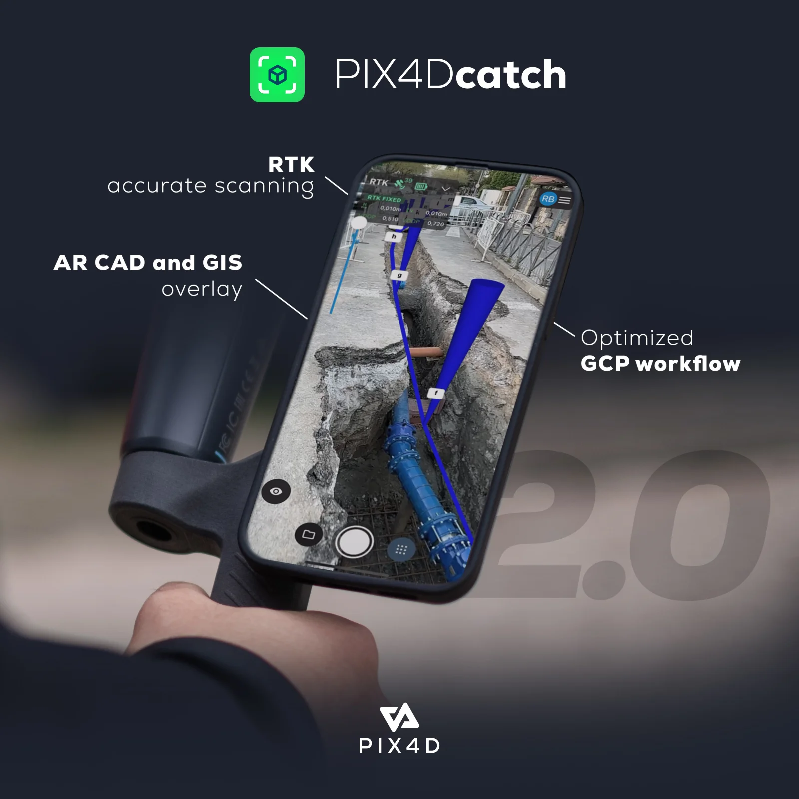
Pix4Dcatch is a mobile data capture application from Pix4D that enables professionals to create accurate, georeferenced 3D models and point clouds directly from a smartphone or tablet. By combining photogrammetry and LiDAR technology, it delivers survey-grade results without requiring dedicated hardware beyond a compatible mobile device. The app features an intuitive AR interface that provides real-time scan coverage feedback via a 3D mesh overlay and live point cloud viewer, ensuring complete and high-quality captures every time. For projects requiring absolute centimeter-level accuracy, Pix4Dcatch integrates seamlessly with RTK devices. Its innovative AR capabilities also allow users to overlay DXF, IFC, or SHP design files directly onto the real-world scan for construction verification, volume measurement, and as-built comparisons. Captures can be paused and resumed at any time, and the processed data can be uploaded directly to PIX4Dcloud or exported to PIX4Dmatic and PIX4Dmapper for further analysis and reporting. Use cases span land surveying, civil engineering, construction site verification, forensic scene documentation, and subsurface utilities mapping. A free Discovery license lets new users explore basic 3D scanning, while Standard and Pro tiers unlock data export, cloud processing, RTK support, and advanced AR features for professional workflows.
Key Features
- Georeferenced 3D Scanning: Capture detailed, georeferenced 3D models and point clouds using both photogrammetry and LiDAR directly from a smartphone.
- RTK Integration for Centimeter Accuracy: Connect compatible RTK devices to achieve absolute centimeter-level positional accuracy in all 3D outputs.
- AR Design Overlay & Verification: Overlay DXF, IFC, or SHP CAD and design files onto the live scan in augmented reality to compare as-built conditions against plans.
- Real-Time Coverage Feedback: A live 3D mesh overlay and point cloud viewer provide instant AR feedback on scan completeness, ensuring full coverage before leaving the site.
- Flexible Processing & Export: Upload captures directly to PIX4Dcloud or export to PIX4Dmatic and PIX4Dmapper for advanced processing, reporting, and team collaboration.
Use Cases
- Documenting subsurface utility trenches with quick 3D scans and AR visualization even after site closure
- Verifying construction progress by overlaying CAD and BIM design files onto live site scans in augmented reality
- Conducting land surveys with a streamlined mobile workflow that integrates directly with PIX4Dmatic and PIX4Dcloud for reporting
- Capturing forensic scenes with a secure, offline-capable workflow that merges drone and mobile phone data into comprehensive 3D models
- Performing civil engineering site verification by comparing real-world conditions to design overlays and uploading results for team collaboration
Pros
- Free Discovery Tier: Users can explore 3D scanning and basic GPS georeferencing at no cost, lowering the barrier to entry for new users.
- Deep Pix4D Ecosystem Integration: Seamlessly connects with PIX4Dcloud, PIX4Dmatic, and PIX4Dmapper, enabling end-to-end professional surveying workflows from capture to deliverable.
- AR-Powered Construction Verification: Overlay CAD and design files in augmented reality on-site, reducing the need for post-processing comparisons and accelerating project reviews.
- Versatile Industry Applications: Covers a wide range of professional use cases including land surveying, forensics, civil engineering, construction, and utilities mapping.
Cons
- Advanced Features Require Paid Pix4D Licenses: Data export, cloud processing, and pro AR features are locked behind Standard or Pro tiers that depend on existing PIX4Dcloud, PIX4Dmatic, or PIX4Dmapper subscriptions.
- Centimeter Accuracy Needs Additional Hardware: Achieving RTK-grade absolute accuracy requires purchasing and connecting a compatible RTK device, adding cost and complexity.
- Ecosystem Lock-In: Optimal workflows are tightly coupled to the Pix4D product suite, which may limit flexibility for teams using third-party processing platforms.
Frequently Asked Questions
Is Pix4Dcatch free to use?
Yes, the Discovery license is free and allows users to explore 3D scanning with LiDAR, GPS georeferencing, point measurements, and GCP creation. Advanced features like data export and cloud processing require a Standard or Pro license tied to a Pix4D subscription.
What devices are compatible with Pix4Dcatch?
Pix4Dcatch is designed for smartphones and tablets that support LiDAR scanning (such as recent iPad Pro and iPhone Pro models) as well as standard photogrammetry-capable devices. Check the Pix4D website for the full compatibility list.
How do I achieve centimeter-level accuracy with Pix4Dcatch?
By connecting a compatible RTK (Real-Time Kinematic) device to your mobile device, Pix4Dcatch can achieve absolute centimeter accuracy in the resulting 3D models and point clouds.
What file formats can be exported from Pix4Dcatch?
Captured data including images, point clouds, GCPs, marks, and site localization files can be exported. The app also supports uploading directly to PIX4Dcloud or transferring to PIX4Dmatic or PIX4Dmapper for further processing.
Can I use Pix4Dcatch for construction site verification?
Yes. Pix4Dcatch supports overlaying DXF, IFC, and SHP design files in augmented reality directly on the scan, enabling real-time comparison of as-built conditions against CAD plans, volume measurement, and construction progress tracking.