
S
About
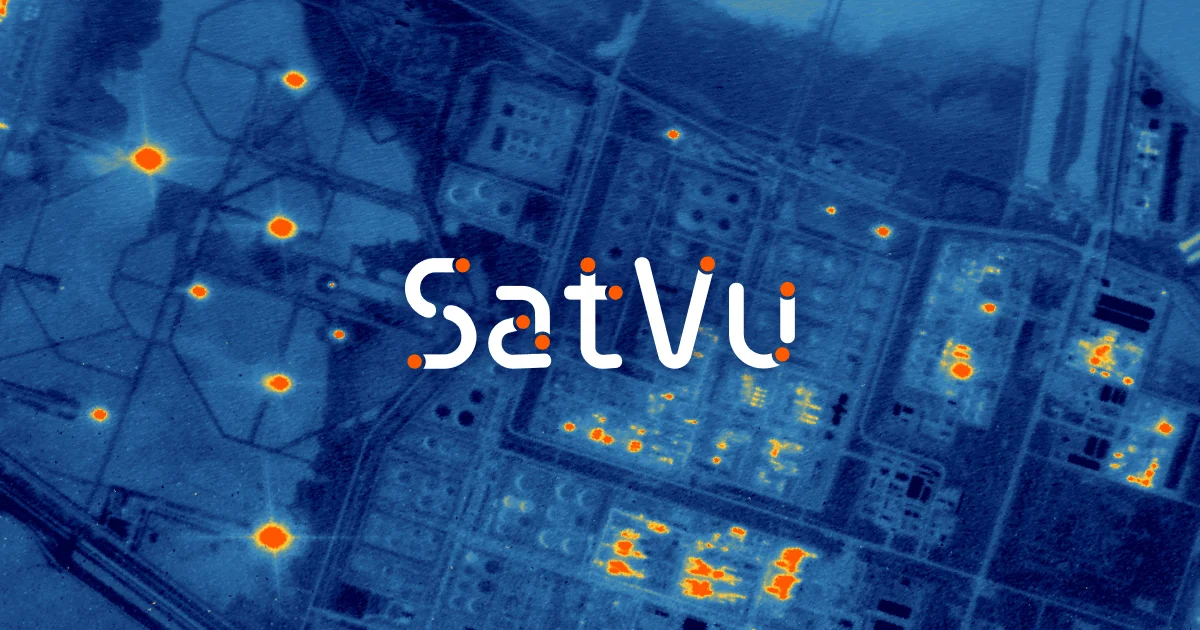
Satellite Vu (SatVu) is a space-tech data company delivering unparalleled 3.5-metre resolution thermal infrared imagery captured from low Earth orbit. Its flagship satellite, HotSat-1 — launched on a SpaceX Falcon 9 in June 2023 — is the world's first commercially available high-resolution infrared imaging satellite, with HotSat-2 and HotSat-3 in development for 2025 as part of a planned 9-satellite constellation providing 10–20 revisits per day. Unlike visible-light imagery that only shows the outside of structures during daylight, SatVu's thermal data penetrates to reveal activity signatures inside buildings, day or night, and can even see through smoke. Compared to legacy thermal satellites like Landsat (≈100 m resolution), SatVu's 3.5 m resolution represents a transformative leap forward in monitoring fidelity. Key applications include national security (monitoring facilities and activity in restricted or inaccessible regions), economic monitoring (tracking energy consumption, industrial activity, and infrastructure), and climate resilience (urban heat island mapping, green-space planning, and climate impact assessments). SatVu also offers the unique capability of delivering thermal data as short videos — up to 60 seconds — enabling movement tracking across built and natural environments. The platform is globally scalable, covering any point on Earth's surface uniformly, overcoming the limitations of drone- or aircraft-based thermal surveys. SatVu's data is available via tasking, catalog access, and custom analytics partnerships, making it ideal for government, defense, energy, and research organizations.
Key Features
- 3.5 m Thermal Resolution: Industry-leading 3.5-metre resolution thermal infrared imagery — far surpassing legacy satellites like Landsat at ~100 m — enabling precise detection of heat signatures across structures and terrain.
- Day & Night Imaging: Unlike optical satellites limited to daylight, SatVu's thermal sensors capture activity 24/7, including through smoke, making it a critical night-time optical substitute.
- Thermal Video Capability: The only commercial satellite provider offering thermal data as video clips up to 60 seconds, allowing users to track movement and dynamic activity across the built and natural environment.
- Global Coverage via Constellation: A growing constellation of HotSat satellites delivers uniform global coverage — including inaccessible and restricted areas — with 10–20 revisits per day at full build-out.
- Activity-Inside-Structure Detection: Thermal signatures can reveal operational activity inside buildings and facilities — a capability not possible with standard visible-light imagery — critical for security and economic intelligence.
Use Cases
- Defense and intelligence agencies monitoring military facility activity, equipment movement, or restricted-area operations day and night without detection.
- Energy analysts tracking industrial plant output, pipeline activity, and power infrastructure health to inform commodity trading and investment decisions.
- City planners and climate scientists mapping urban heat islands, assessing green infrastructure effectiveness, and prioritizing heat mitigation interventions.
- Financial institutions and hedge funds using thermal signatures as an alternative data layer to gauge economic activity at factories, ports, and logistics hubs.
- Disaster response teams assessing wildfire spread, industrial accidents, or infrastructure damage using thermal imaging that penetrates smoke and operates at night.
Pros
- Unmatched Thermal Resolution: At 3.5 m resolution, SatVu's imagery is orders of magnitude sharper than any other commercially available thermal satellite data, opening entirely new monitoring use cases.
- Versatile Multi-Sector Applications: A single data source addresses diverse high-value verticals — defense, energy, finance, climate — reducing the need for multiple specialized data providers.
- All-Weather, All-Hours Coverage: Thermal infrared works at night and through smoke, providing continuity of intelligence when optical satellites go blind.
- Unique Video Output: Thermal video clips are a market-first, enabling dynamic analysis like vehicle tracking or industrial process monitoring not possible with still images alone.
Cons
- Enterprise Pricing & Access: SatVu targets government and enterprise clients; pricing is not transparent and requires direct engagement, making it inaccessible for smaller organizations or individual researchers.
- Limited Revisit Frequency Currently: With only HotSat-1 operational as of early 2024, revisit frequency is limited until the full 9-satellite constellation is deployed, reducing near-real-time monitoring capability.
- Niche Domain Expertise Required: Interpreting thermal infrared data effectively requires specialized geospatial and remote sensing expertise, which may create a learning curve for new users.
Frequently Asked Questions
What resolution does SatVu's thermal imagery offer?
SatVu captures thermal infrared imagery at up to 3.5-metre resolution — significantly higher than other commercially available thermal satellites such as Landsat, which operates at around 100 m resolution.
Can SatVu satellites image at night?
Yes. Unlike optical satellites that require reflected sunlight, SatVu's thermal infrared sensors detect heat emissions, enabling full day-and-night imaging. They can also capture imagery through smoke.
What sectors does SatVu serve?
SatVu primarily serves national security and defense, economic monitoring (energy, commodities, infrastructure), and climate resilience (urban heat mapping, green-space planning, climate impact assessment).
How many satellites does SatVu currently operate?
HotSat-1 was launched in June 2023 and is currently operational. HotSat-2 and HotSat-3 are in development for 2025, with a planned constellation of 9 satellites delivering 10–20 revisits per day globally.
How can I access SatVu data?
SatVu data is available through tasking (commissioning new captures), catalog access (archived imagery), and strategic analytics partnerships. Interested organizations can contact SatVu directly or request a demo via their website.