

About
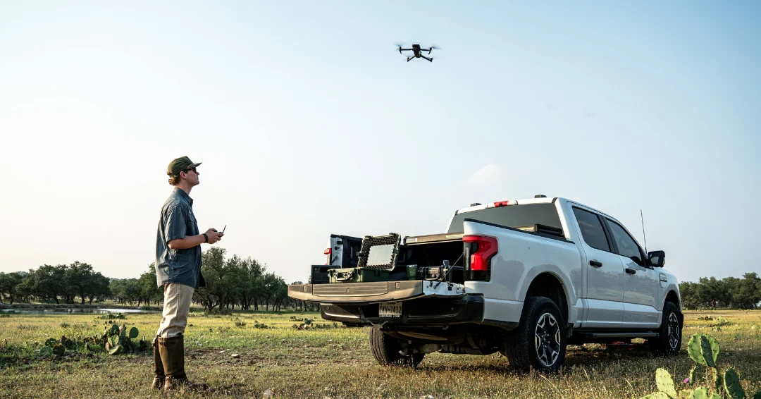
Sky Senderos is a specialized wildlife survey company that uses advanced thermal drone technology to help Texas ranch owners and landowners collect precise, actionable data on their game animal populations. Traditional survey methods like helicopter flyovers, spotlight surveys, and trail cameras are often inaccurate, stressful for animals, and expensive — Sky Senderos addresses all three shortcomings. Using thermal imaging drones, the team can detect animals even through thick brush and complete a full property survey in a single night, delivering results within the same week. Clients receive detailed census data including total animal counts, buck-to-doe ratios, fawn crop and retention numbers, and — with optional add-ons — interactive maps showing where animals are distributed across the property. A visible 56x zoom camera add-on provides highly detailed species identification alongside the thermal data. The service supports compliance with the Texas Managed Lands Deer Program (MLDP), which can extend hunting seasons and increase tag allotments. It also helps landowners qualify for wildlife exemptions to reduce property taxes, supports wildlife management planning, and provides credible population data for buyers and sellers during property transactions. Sky Senderos has earned strong reviews from ranch owners across Texas and Alabama for professional service, minimal environmental footprint, and the ability to obtain airspace clearances in challenging locations such as areas near military bases.
Key Features
- Thermal Game Count: Advanced thermal imaging detects animals even through dense brush, delivering the most accurate wildlife population counts available — far surpassing helicopter, spotlight, or trail-cam methods.
- Interactive Game Map Add-On: An optional interactive online map shows not just how many animals are on the property, but exactly where they are distributed — enabling smarter habitat and hunting management decisions.
- Visible 56x Zoom Camera Add-On: A high-powered visible camera works alongside the thermal camera for detailed species identification and close-up views of individual animals during the survey flight.
- Same-Week Results: The entire property can be surveyed in a single overnight flight, with reviewed census results delivered to the landowner within the same week.
- MLDP & Wildlife Exemption Support: Survey data supports compliance with Texas's Managed Lands Deer Program to extend hunting seasons and obtain more tags, and helps landowners qualify for wildlife exemptions that reduce property taxes.
Use Cases
- Deer herd management for hunting ranches needing accurate population counts before and after hunting seasons.
- Texas MLDP program compliance to qualify for extended hunting seasons and additional harvest tags.
- Wildlife tax exemption documentation to help landowners reduce property tax liability through certified wildlife management.
- Property valuation support, providing credible, data-backed animal population numbers for buyers and sellers during real estate transactions.
- Predator control and habitat improvement planning using precise census data to identify population imbalances and wildlife distribution across the property.
Pros
- More Accurate Than Traditional Methods: Thermal drone surveys consistently outperform helicopter surveys, spotlight counts, and trail cameras in accuracy, especially in heavy cover terrain.
- Fast Turnaround: Full property surveys completed overnight with results delivered within the same week, enabling timely wildlife management decisions.
- Animal-Safe & Low-Impact: Drones cause no stress to animals and do not risk herding them into fences or off the property, unlike helicopter surveys.
- Versatile Airspace Capabilities: The team can coordinate airspace clearances even in restricted areas near military installations, expanding service availability.
Cons
- Primarily Texas-Focused: Services are concentrated in Texas, with limited coverage for landowners in other states, though some out-of-state surveys have been conducted.
- Quote-Based Pricing: No transparent pricing is published; landowners must contact the company for a quote, making upfront cost comparison difficult.
- Nighttime Survey Requirement: Thermal surveys are conducted at night for best accuracy, which may require coordination and access arrangements from the landowner.
Frequently Asked Questions
Why are thermal drone surveys more accurate than helicopter or spotlight surveys?
Thermal cameras detect heat signatures from animals even through thick brush and at night, conditions where helicopters and spotlights frequently miss animals. Drones can also fly lower and slower, reducing the chance of missing animals hiding in dense vegetation.
How long does a survey take and when will I get my results?
Sky Senderos can survey an entire property in a single overnight flight. Reviewed results — including total counts, ratios, and optional maps — are typically delivered to the client within the same week as the survey.
What data will I receive from a survey?
The base thermal game count provides total animal counts, buck-to-doe ratios, and fawn crop and retention data. Optional add-ons include an interactive online map showing animal locations across your property and detailed visible-camera imagery for species identification.
Can Sky Senderos fly over my property if it is near a military base or in restricted airspace?
Yes. Sky Senderos has a track record of coordinating with military and aviation authorities to obtain the necessary airspace clearances, including documented surveys conducted adjacent to U.S. Air Force bases.
How can survey data help with Texas property taxes or hunting regulations?
Accurate population data from a thermal drone survey can support qualification for the Texas Wildlife Exemption, which can significantly reduce property tax liability. Survey results also support participation in the Texas Managed Lands Deer Program (MLDP), which may extend your hunting season and provide additional deer tags.