

About
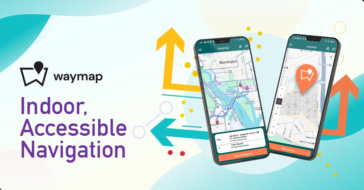
Waymap is a groundbreaking navigation application that solves one of the most persistent challenges in accessibility: reliable, accurate indoor and underground navigation. Unlike GPS-based apps that fail the moment you step inside a building or descend into a subway, Waymap works everywhere — shopping centres, airport terminals, sports stadiums, university campuses, and underground transit systems. Powered by a proprietary algorithm that relies solely on a smartphone's built-in motion sensors and the user's steps, Waymap requires no WiFi, GPS, Bluetooth beacons, or any external hardware. This makes deployment for venues zero-infrastructure: no beacons to install, no wiring, no sensor networks to maintain — just a digital map. The app delivers heads-up, hands-free audio navigation so users can keep their phone in their pocket and follow spoken instructions through any headphones. It learns each individual's walking style over time, making its step-level accuracy increasingly personal and reliable. Founded by Dr. Tom Pey, Waymap was built from the ground up with blind and low-vision users at the centre of its design philosophy. It has mapped over 1 billion square feet across 140+ live venues in 10+ cities. For venues and transit operators, Waymap strengthens ESG credentials, reduces visitor confusion, and replaces static signage with a dynamic, multilingual digital system that can be updated instantly.
Key Features
- GPS-Free Navigation: Uses only the smartphone's built-in motion sensors — no WiFi, GPS, Bluetooth beacons, or external signal required to navigate anywhere.
- Step-Level Accuracy: Navigation is accurate to the individual step, and the app learns each user's unique walking style over time for increasingly personalised precision.
- Heads-Up, Hands-Free Audio Guidance: Audio instructions allow users to keep their phone pocketed and navigate using any headphones, keeping hands and eyes free at all times.
- Zero-Infrastructure Venue Deployment: No hardware, beacons, or wiring needed. Venues only need to provide a digital map, drastically reducing deployment and ongoing maintenance costs.
- Universal Coverage — Indoor, Outdoor, Underground: Seamlessly transitions between underground transit, shopping centres, stadiums, and outdoor spaces in a single continuous navigation experience.
Use Cases
- A blind commuter independently navigating from street level down to an underground subway platform and locating their specific train without any assistance.
- A shopping centre providing accessible, turn-by-turn indoor navigation to help all visitors — including those with disabilities — find stores, exits, and amenities.
- A sports stadium guiding tens of thousands of fans to their exact seats without relying on static printed signage or staff assistance.
- A university campus enabling students with visual impairments to independently navigate buildings and lecture halls for the first time.
- A transit authority offering multilingual, real-time wayfinding across their entire underground network with zero beacon infrastructure deployment.
Pros
- Works Without Any Signal: Completely offline operation means it functions in basements, tunnels, and signal-dead zones where all other navigation apps fail.
- Genuinely Accessible by Design: Built first for blind and low-vision users, making accessibility a core feature rather than an afterthought, benefiting all users.
- No Hardware Required for Venues: Zero-infrastructure deployment eliminates costly beacon installations, making it practical and affordable for large venues and transit operators.
- Adaptive & Personalised Over Time: The app learns individual walking patterns to improve accuracy continuously, delivering a navigation experience that improves the more you use it.
Cons
- Limited Venue Coverage: With 140+ live venues, coverage is still growing — the app may not yet support your local transit hub, campus, or shopping centre.
- Venue Mapping Onboarding Required: New venues must be mapped and onboarded before users can navigate them, adding a setup lead time for newly added locations.
- Mobile-Only for End Users: Currently available only as a mobile app with no desktop or web-based navigation interface for individual users.
Frequently Asked Questions
How does Waymap navigate without GPS or WiFi?
Waymap uses a proprietary algorithm that relies solely on the built-in motion sensors (accelerometer, gyroscope, barometer) of your smartphone combined with your step count. By analysing how you move, it calculates your position and route without any external signal or infrastructure.
Is Waymap free to use?
The Waymap app is free to download and use for individuals. Venues and organisations that want to be mapped and listed on the platform work with Waymap on a partnership and licensing basis.
What kinds of venues does Waymap support?
Waymap supports underground transit systems, shopping centres, sports stadiums, airports, university campuses, and more. It has mapped over 1 billion square feet across 140+ live venues in 10+ cities globally.
Is Waymap only for people with disabilities?
Waymap was founded with blind and low-vision users at its core, but it is designed for everyone. Its audio-first, hands-free approach benefits any user who needs reliable indoor navigation — including tourists, commuters, and general venue visitors.
Does a venue need to install hardware to use Waymap?
No. Waymap requires zero hardware — no Bluetooth beacons, wiring, or sensor networks. All that is needed is a digital map of the venue, making deployment fast, scalable, and cost-effective.