

About
WebODM is a powerful, community-driven drone mapping solution built on open photogrammetry technology. It processes aerial and ground images from virtually any camera — consumer smartphones, professional rigs, fisheye, 360°, and multispectral sensors — to produce georeferenced outputs including orthomosaics, digital surface models (DSMs), digital terrain models (DTMs), classified LiDAR-style point clouds, and textured 3D models in OBJ and OGC 3D Tiles formats. Designed for surveyors, researchers, agronomists, and GIS professionals, WebODM includes built-in tools for volume and area measurements, stockpile tracking, plant health indexes (NDVI, VARI, GNDVI), elevation contour export to AutoCAD/ShapeFile/GeoPackage, and Ground Control Point (GCP) support for centimeter-level accuracy. All outputs can be exported in high-resolution GeoTIFF, PNG, LAS/LAZ, and OBJ formats. WebODM runs entirely on your own infrastructure — desktop, server, or cloud — with GPU acceleration via CUDA for faster processing. It supports 16+ languages, allows full rebranding, and scales horizontally using ClusterODX for parallel multi-job workloads. The broader WebODM ecosystem includes ODX (photogrammetry engine), NodeODX (REST API), PyODX (Python SDK), CloudODX (CLI cloud processing), and OATS (testing tools), making it a complete platform for any aerial data pipeline.
Key Features
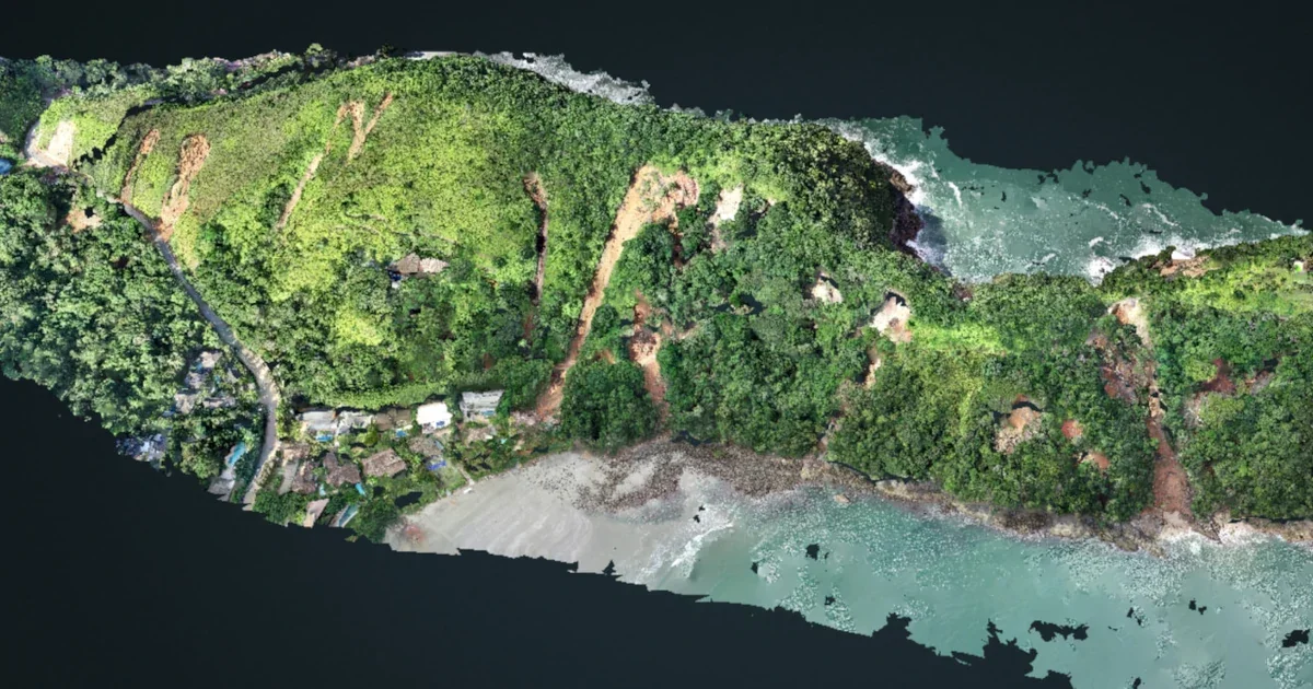
- Orthomosaic & Elevation Models: Produces georeferenced, orthorectified maps alongside digital surface models (DSMs) and terrain models (DTMs) from drone imagery.
- 3D Model Generation: Generates textured 3D models in OBJ and OGC 3D Tiles formats from aerial and oblique images, ready for export and sharing.
- Plant Health & Multispectral Analysis: Computes vegetation indices including NDVI, VARI, and GNDVI from multispectral imagery for precision agriculture and environmental monitoring.
- Measurements & GCP Support: Enables volume, area, and stockpile measurements directly in the browser, with Ground Control Points for centimeter-level positional accuracy.
- Scalable Ecosystem & GPU Acceleration: Includes companion tools (ODX, NodeODX, ClusterODX, PyODX) for distributed processing, REST API access, Python SDK integration, and CUDA-powered GPU acceleration.
Use Cases
- Surveying and mapping large land areas using drone imagery to produce high-accuracy georeferenced orthomosaics and elevation models.
- Precision agriculture applications such as crop health monitoring using NDVI and multispectral vegetation indices from drone flights.
- Construction site monitoring and stockpile volume estimation with repeated drone surveys and built-in measurement tools.
- Environmental research and conservation efforts requiring detailed 3D terrain models, contour maps, and classified point clouds.
- GIS professionals and developers building aerial data pipelines by integrating PyODX, NodeODX REST APIs, or ClusterODX into custom applications.
Pros
- Completely Free and Open Source: No licensing fees or subscriptions — the full feature set is available at no cost, with source code freely available for customization.
- Offline & Self-Hosted: Runs entirely on your own hardware with no internet dependency, ensuring data privacy and full control over sensitive aerial datasets.
- Comprehensive Output Formats: Exports to GeoTIFF, LAS/LAZ, OBJ, OGC 3D Tiles, ShapeFile, GeoPackage, and more, ensuring compatibility with major GIS and CAD platforms.
- Flexible & Scalable Architecture: Scales from single-machine desktop use to distributed cloud processing via ClusterODX, supporting both hobbyist and enterprise workloads.
Cons
- Steep Learning Curve: Processing photogrammetry pipelines and configuring GCPs, coordinate systems, and export options can be complex for non-technical users.
- Resource-Intensive Processing: Large datasets require significant RAM, CPU, and optionally GPU resources, which may be a barrier for users on modest hardware.
- Community-Driven Support: Support relies on community forums and documentation rather than a dedicated commercial support team, which can slow troubleshooting.
Frequently Asked Questions
Is WebODM really free?
Yes. WebODM is completely free and open source under an open license. You can download, use, modify, and redistribute it at no cost.
What types of cameras and images does WebODM support?
WebODM supports images from consumer smartphones, professional cameras, fisheye lenses, 360° cameras, and multispectral sensors. It processes JPG and TIFF files (8-bit and 16-bit), with or without EXIF data, captured nadir or oblique.
Can WebODM run offline?
Yes. WebODM is designed to run locally on your own computer or server, with no internet connection required for processing.
How does WebODM scale for large projects?
WebODM supports horizontal scaling through ClusterODX, which acts as a load balancer and task tracker across multiple NodeODX nodes. CloudODX also enables cloud-based processing via the command line.
What is the difference between WebODM and ODX?
ODX is the underlying open source photogrammetry engine that handles the actual image processing. WebODM is the user-facing web application and project management layer built on top of it, providing a GUI, task management, map viewer, and export tools.