

About
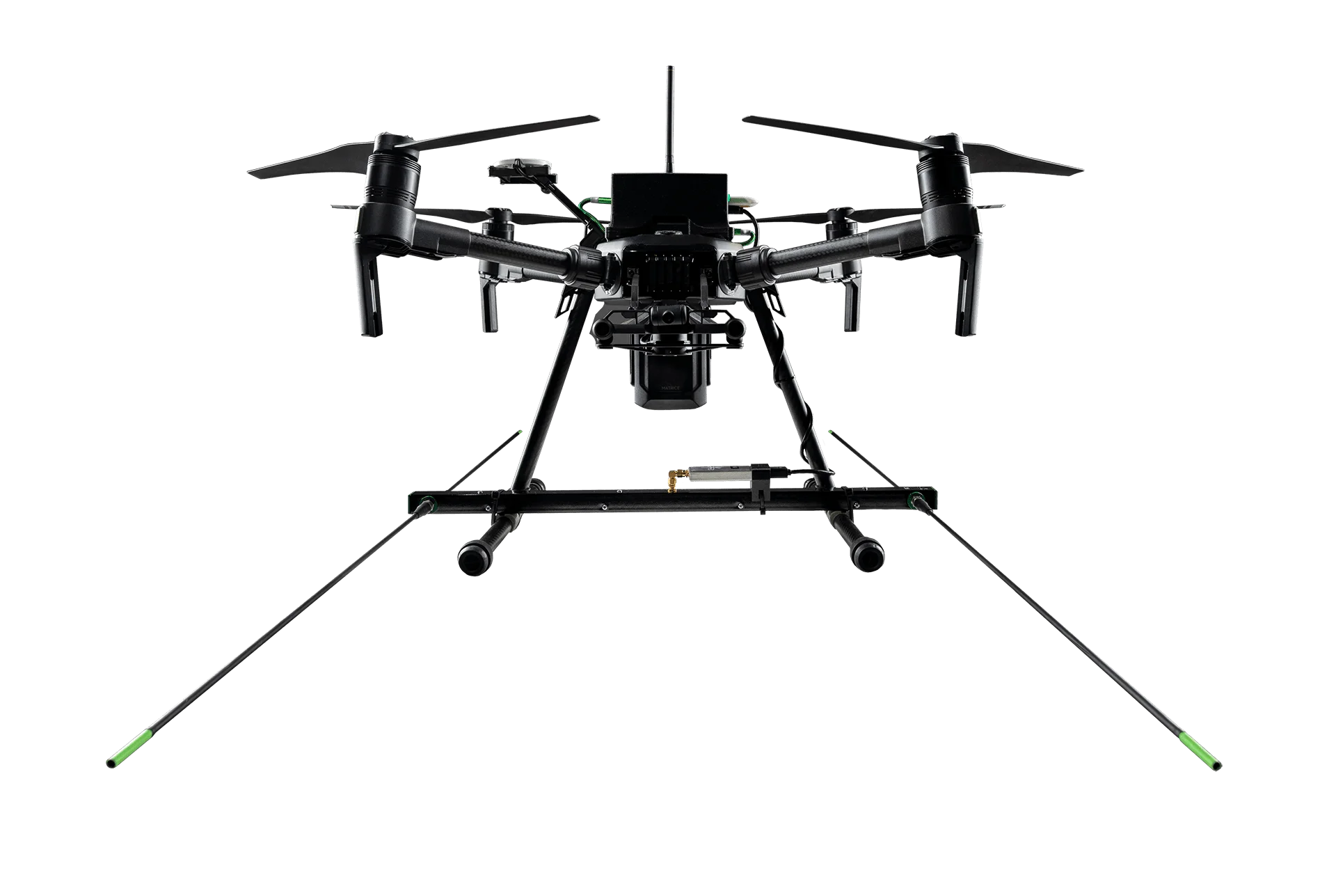
Wildlife Drones is an industry-leading technology company specializing in drone-based radio-telemetry systems designed to revolutionize wildlife tracking and conservation monitoring. Their flagship system integrates unique sensor technology with drone platforms — including the Freefly Astro — to locate radio-tagged animals in real-time, even in challenging environments such as wetlands, rugged mountains, and dense forests. The system supports simultaneous tracking of up to 40 animals and is fully compatible with any VHF tags used globally, making it adaptable for diverse wildlife projects worldwide. By replacing traditional on-foot or vehicle-based radio tracking, Wildlife Drones empowers teams to complete a full day's manual tracking work in under two hours, dramatically reducing labor costs and minimizing disturbance to animals and their habitats. Wildlife Drones serves a wide range of clients including government departments, universities, environmental consultancies, and private industries. Use cases span conservation of endangered species (bats, koalas, quolls, finches), invasive species management (giant hornets), livestock monitoring, thermal imaging surveys, and environmental impact assessments. The company also offers drone pilot training and licensing, animal tracking services, and thermal imaging as complementary service offerings. It is a trusted partner for wildlife professionals seeking to scale up monitoring operations efficiently and cost-effectively.
Key Features
- Track Up to 40 Animals Simultaneously: The drone-mounted sensor system can detect and log radio signals from up to 40 VHF-tagged animals in a single flight, massively increasing data collection efficiency.
- Universal VHF Tag Compatibility: Compatible with any VHF animal tags used globally, making the system flexible enough for virtually any wildlife research or conservation project worldwide.
- Thermal Imaging Surveys: Integrated thermal imaging capabilities allow teams to detect and survey wildlife populations in low-visibility conditions, including dense vegetation and nighttime environments.
- Rapid Terrain Coverage: Covers wetlands, mountain ranges, and other difficult terrain quickly and with minimal habitat disturbance compared to traditional ground-based tracking methods.
- End-to-End Tracking Services: Beyond hardware, Wildlife Drones offers managed animal tracking services, drone pilot training, and licensing support for teams needing full operational assistance.
Use Cases
- Tracking endangered species such as bats, koalas, and eastern quolls across large and inaccessible natural habitats
- Managing invasive species populations by rapidly locating and monitoring radio-tagged individuals across wide territories
- Conducting thermal imaging population surveys to census wildlife in dense vegetation or at night
- Supporting environmental impact assessments by providing precise animal location data for government and industry projects
- Monitoring livestock movements and welfare across large pastoral properties using VHF telemetry from drones
Pros
- Dramatically Reduces Tracking Time: Replaces an entire day of manual radio-tracking with less than two hours of drone-based data collection, saving significant time and operational costs.
- Minimal Wildlife Disturbance: Aerial tracking is far less intrusive than ground-based methods, reducing stress on animals and limiting habitat disruption during surveys.
- Globally Compatible Technology: Works with any VHF tags worldwide, allowing seamless integration into existing research programs without requiring new tag infrastructure.
- Proven Across Diverse Species and Environments: Case studies demonstrate successful use with bats, koalas, quolls, rhinos, finches, giant hornets, and more — across multiple continents and terrain types.
Cons
- Requires Drone Operation Expertise: Teams must be licensed and trained drone pilots to operate the system, which may require additional investment in training or personnel.
- Hardware and Service Costs: As a specialized commercial system, upfront hardware and ongoing service costs may be significant for smaller research teams or NGOs with limited budgets.
- Weather and Airspace Dependent: Drone operations are subject to weather conditions and local airspace regulations, which can limit deployment in certain regions or during adverse conditions.
Frequently Asked Questions
What types of animals can be tracked with Wildlife Drones technology?
The system can track any animal fitted with a VHF radio tag. Past projects have included bats, koalas, quolls, finches, rhinos, giant hornets, and various livestock species.
Is the system compatible with existing VHF tags?
Yes. Wildlife Drones' sensor technology is compatible with any VHF tags used globally, so researchers do not need to replace or upgrade existing tagging infrastructure.
How many animals can be tracked in a single flight?
The drone system can simultaneously detect and track up to 40 radio-tagged animals during a single flight mission.
Do we need special drone pilots to operate the system?
Operators need to be licensed drone pilots. Wildlife Drones offers drone pilot training and licensing programs to help teams get certified and proficient with the technology.
Who are the typical clients of Wildlife Drones?
Clients include government departments, universities, environmental consultants, and private industries involved in conservation, invasive species management, livestock monitoring, and environmental impact assessments.